Titoki Climate & Temperature ⛅
⛳ Titoki is situated in or near the warm temperate dry forest biome.
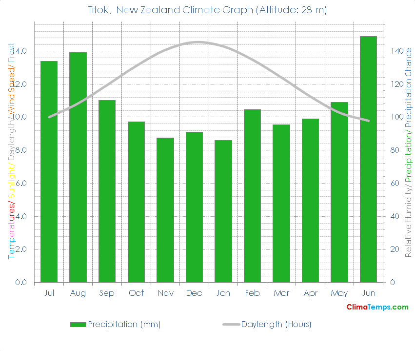
☔ Total annual precipitation averages 1301.9 mm (51.3 inches) which is equivalent to 1301.9 Litres/m² (31.93 Gallons/ft²).
Embed this graph on your webpage!
Simply paste the following HTML code into your webpage. Please include a link back to this website. There is one in the following code already. Edit the width attribute to change the size of the graph if needed:
✨ The longest day of the year is 14:25 long on the 21 of December and the shortest day is 9:34 long on the 22 of June.
🐇Were you to burrow down through the centre of the Earth from Titoki you would pop up nearest to the climate station at Tangier, Morocco where you would find a Mediterranean climate (Warm temperate dry forest biome).
🌍Titoki, New Zealand is at 35°43'S, 174°3'E, 28 m (92 ft). Check the location on the map.
Titoki Climate Table
| Jul | Aug | Sep | Oct | Nov | Dec | Jan | Feb | Mar | Apr | May | Jun | Annual | |
|---|---|---|---|---|---|---|---|---|---|---|---|---|---|
| 134 (5) | 139 (5) | 110 (4) | 97 (4) | 88 (3) | 91 (4) | 86 (3) | 105 (4) | 95 (4) | 99 (4) | 109 (4) | 149 (6) | 1302 (51) |
| Jul | Aug | Sep | Oct | Nov | Dec | Jan | Feb | Mar | Apr | May | Jun | Annual | |
|---|---|---|---|---|---|---|---|---|---|---|---|---|---|
| 10h 00' | 10h 50' | 11h 56' | 13h 06' | 14h 03' | 14h 32' | 14h 17' | 13h 28' | 12h 24' | 11h 14' | 10h 16' | 9h 46' | 12h 00' |
| 33.8 | 42.1 | 53.5 | 64.6 | 73.8 | 77.7 | 74.1 | 64.8 | 54.1 | 42.5 | 34.2 | 30.9 | 53.9 |